Converting Tracks to Routes
AvNav continously records tracks. A new track file (gpx) is generated every day.
Those tracks (or tracks uploaded via Files/Download page) can be converted to routes to be used in navigation.
Concept
This conversion typically requires to reduce the number of points in the track as they often contain more than 1000 points. Otherwise using such a route is unfeasible.
AvNav is using an algorithm similar to GPS Babel. One by one, points with smallest distance from the vector between the two neighboring points are eliminated.
You can provide a parameter (Xte) to define the maximum tolerable distance. The larger distance you allow, the fewer points the created route will contain. For usabilty reasons, you should try to keep your routes below 50 waypoints.
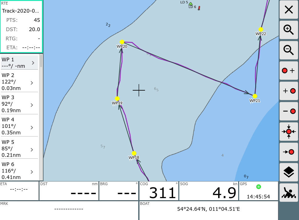
After the conversion you can fine tune the route in the Route-Editor.
Handling
You enter the conversion dialog either from the Files/Download page
from within the Track Info
Dialog (![]() Convert
Button) or from the info dialog if you have the track selected as an Overlay
on the chart and click on a point within it. Again, you press the
Convert
Button) or from the info dialog if you have the track selected as an Overlay
on the chart and click on a point within it. Again, you press the ![]() Convert
Button - see picture.
Convert
Button - see picture.
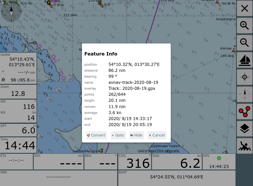
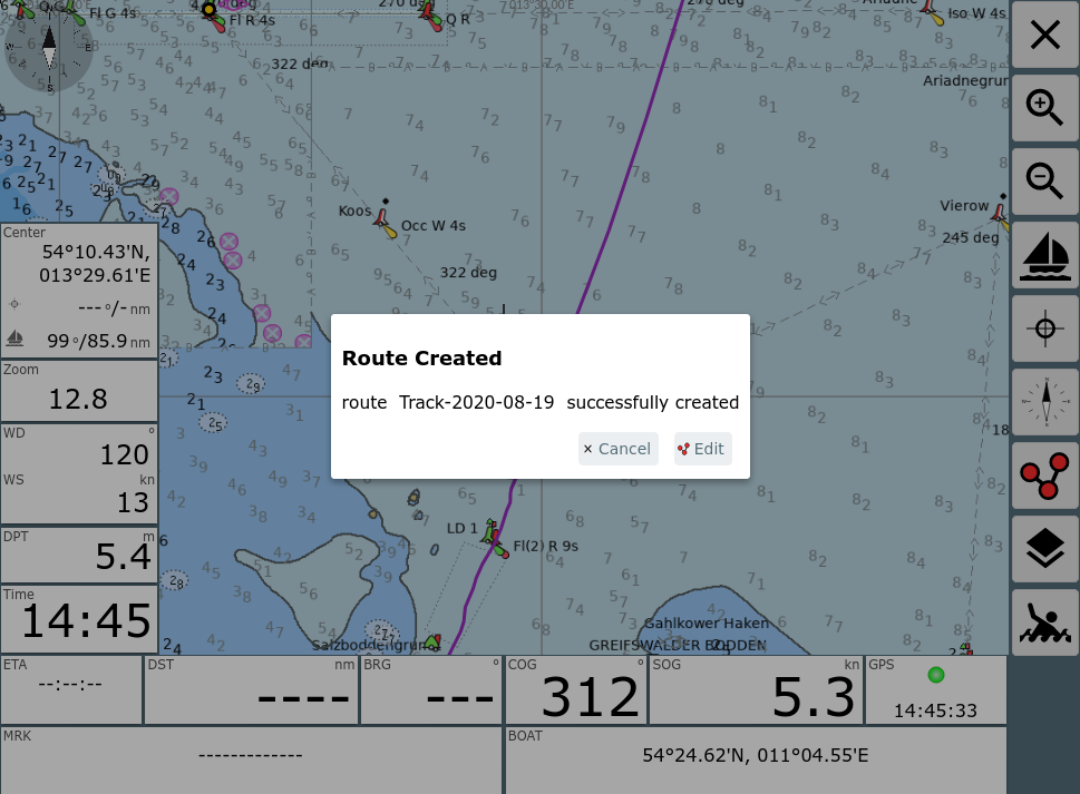
After clicking "Convert" the conversion dialog pops up.
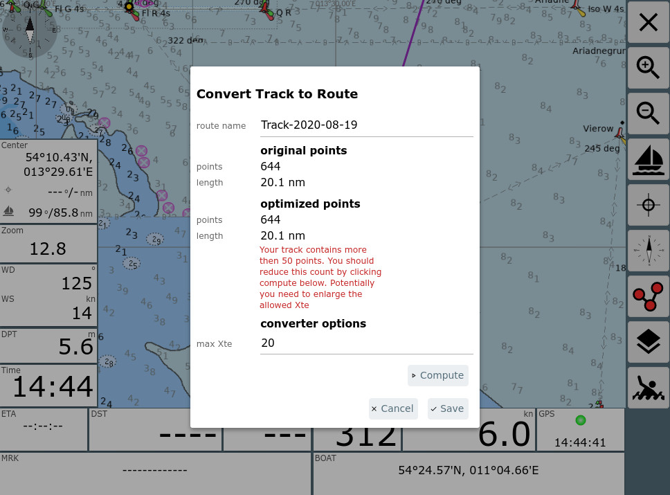
Normally (as in the picture) you will see a warning about point count exceeding 50.
Using "max Xte" you configure the converter and start the conversion clicking "Compute". If the number of points still does not fit you can try again with a different Xte.
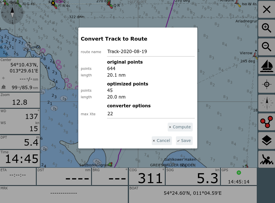
In above example a max Xte of 22m produced a good route.
Within the dialog you can change the name for the new route (and decide to potentially overwrite an existing one with the same name).
After saving you can directly start editing the route.
At this point you preferrably have the track displayed as an overlay to the chart, so you can easily check if all the important track waypoints are included in the route.